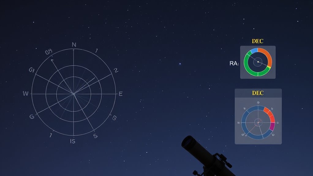
When working with advanced RA and DEC, make certain you convert these coordinates accurately using precise formulas that account for your local sidereal time and latitude. Avoid common pitfalls like confusing coordinate systems or skipping data validation. Don’t forget to adjust for precession, nutation, and proper motion to keep positions current. Using reliable software helps maintain accuracy. Keep these tips in mind, and you’ll master how to handle celestial coordinates effectively as you explore further.
Key Takeaways
- Do validate input units and coordinate system conventions before conversions to prevent errors.
- Do incorporate precession, nutation, and proper motion corrections for accurate epoch transformations.
- Do not confuse equatorial coordinates (RA/DEC) with horizontal coordinates (altitude/azimuth).
- Do use reliable software and real-time catalogs to keep celestial positions current and precise.
- Do verify and cross-check transformed coordinates with known star charts or database references.
astronomy coordinate conversion software
As an affiliate, we earn on qualifying purchases.
As an affiliate, we earn on qualifying purchases.
Correctly Converting Between Equatorial and Horizontal Coordinates
Have you ever wondered how astronomers switch between equatorial and horizontal coordinate systems? It’s essential for accurate celestial navigation. To convert, you start with the object’s right ascension (RA) and declination (DEC), which are fixed to the celestial sphere. You then use your local sidereal time and observer’s latitude. The transformation involves calculating the hour angle from RA and then applying trigonometric formulas to find altitude and azimuth. This process helps you pinpoint objects in the sky relative to your position on Earth. Properly converting between these coordinate systems guarantees your telescope points precisely where you want. Mastering these conversions is key to understanding the sky’s layout and performing reliable observations in celestial navigation. Understanding the celestial sphere is fundamental to grasping how these coordinate systems relate to each other.

Celestial Navigation: A Complete Home Study Course, Second Edition
As an affiliate, we earn on qualifying purchases.
As an affiliate, we earn on qualifying purchases.
Avoiding Common Mistakes in Coordinate Transformations

Are you aware of the common pitfalls that can occur when transforming celestial coordinates? Mistakes often happen if you neglect proper data validation or misunderstand the coordinate system you’re working with. To avoid errors:
- Assume all input data is correct without validation, risking inaccuracies.
- Confuse the coordinate system, mixing equatorial with horizontal coordinates.
- Forget to verify units, leading to incorrect angle conversions.
- Overlook the importance of understanding Myelination and neural efficiency, which can impact how you interpret complex data.
Ensuring you validate your data and confirm the coordinate system before transforming is essential Proper data validation catches errors early, preventing flawed results. Always double-check your input parameters, especially angles and units. Remember, each coordinate system has specific conventions—misunderstanding them can lead to significant mistakes. Staying vigilant in these areas guarantees more accurate transformations and reliable astronomical calculations.

Celestron – AstroMaster 130EQ–MD Newtonian Reflector Telescope for Beginners – Aluminized Mirror – Motor Drive to Track Stars – Adjustable Tripod – Includes Eyepieces Plus Astronomy Software Package
POWERFUL TELESCOPE FOR ASTRONOMY BEGINNERS: The AstroMaster 130EQ-MD delivers sharp optics, a stable equatorial mount, motorized tracking, and…
As an affiliate, we earn on qualifying purchases.
As an affiliate, we earn on qualifying purchases.
Handling Precession, Nutation, and Proper Motion
Handling precession, nutation, and proper motion is essential for precise astronomical coordinate calculations, as these effects cause apparent shifts in celestial positions over time. You must account for precession effects, which gradually change the orientation of Earth’s axis, altering RA and DEC over years. Nutation modeling corrects for short-term oscillations caused by gravitational influences, mainly from the Moon and Sun. Proper motion reflects the star’s actual movement through space, affecting its position over decades. Incorporate precession corrections to transform coordinates between epochs accurately. Use nutation modeling to refine these adjustments, ensuring your data aligns with the current celestial reference frame. Essential Resources and tips for caregivers and seniors can also help you understand complex topics more effectively. By properly addressing these factors, you improve the accuracy of your positional measurements, maintaining consistency across observations and time.

Double-Sided Multi-Latitude Planisphere Star Map Night Sky Guide for Astronomy
NAVIGATE THE NIGHT SKY WITH EASE: This planisphere is a comprehensive sky map for northern hemisphere stargazers located…
As an affiliate, we earn on qualifying purchases.
As an affiliate, we earn on qualifying purchases.
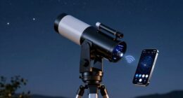
Using the Right Tools and Software for Accurate Positioning
To achieve accurate celestial positioning, selecting the right tools and software is essential. A quality star chart helps you visualize the sky accurately, while reliable software calibration guarantees your data aligns with true positions. Using specialized software simplifies complex calculations, reducing errors in RA and DEC. Focus on tools that support precise measurements and easy updates. Consider these key options:
- Digital star charts with real-time updating features
- Software with built-in calibration functions for accuracy
- Apps that integrate telescope control for seamless tracking
These tools help you verify your observations and maintain precision over time. Proper calibration and the right software make a significant difference in achieving true celestial positioning, especially when working with advanced RA and DEC measurements. Stay current with trusted sources and up-to-date software to keep your data accurate. Calibration processes are fundamental to ensuring your data remains precise and reliable over extended periods.
Best Practices for Tracking and Updating Celestial Data
Maintaining accurate celestial data requires consistent tracking and timely updates to reflect the dynamic nature of the night sky. To excel in celestial navigation, regularly consult reliable astronomical catalogs and update your data accordingly. Always verify your observations against official sources, especially when tracking fast-moving objects or near the horizon. Use software tools that automatically sync with updated catalogs to minimize manual errors. Keep detailed logs of your observations and note any discrepancies for future reference. Adjust your RA and DEC measurements as needed, considering factors like precession and proper motion. Staying current with astronomical data ensures your navigation remains precise. Regularly reviewing and updating your celestial data helps you navigate confidently and adapt to the sky’s constant changes. Incorporating up-to-date astronomical data enhances the accuracy of your celestial navigation efforts.
Frequently Asked Questions
How Does Earth’s Axial Tilt Affect RA and DEC Over Time?
Your Earth’s axial tilt causes seasonal variation in RA and DEC. As Earth orbits the Sun, this tilt shifts the position of stars in the sky, changing their apparent RA and DEC over time. You’ll notice that certain stars are visible at different times of year, and their coordinates subtly vary because of this tilt. This ongoing variation is what creates the changing night sky you observe throughout the seasons.
Can Atmospheric Conditions Influence the Accuracy of RA and DEC Observations?
Imagine trying to see distant fireworks through a humid window—that’s how atmospheric distortion impacts your RA and DEC measurements. Weather variability, like turbulence or temperature changes, can bend and distort incoming light, reducing the accuracy of your observations. Atmospheric conditions definitely influence precision, making it essential to account for these effects during data collection to guarantee your celestial coordinates are as accurate as possible.
What Are the Limitations of Manual Coordinate Conversions?
You encounter calibration challenges and limited instrument precision when performing manual coordinate conversions. These issues can cause errors and reduce accuracy, especially if you don’t regularly calibrate your equipment or if your instruments aren’t highly precise. Manual conversions rely heavily on careful calculations and consistent procedures, but small inaccuracies in calibration or instrument limitations can lead to significant deviations in RA and DEC, impacting your observational accuracy.
How Often Should Celestial Position Data Be Updated for Precision?
Coincidence often highlights how celestial movements subtly change over time. You should update your celestial position data regularly, ideally every few weeks or monthly, to maintain accuracy. Historical data and ongoing software calibration are crucial for precise tracking. This ensures your observations stay aligned with current celestial coordinates, reducing errors caused by Earth’s precession, nutation, and other factors. Staying current keeps your star mappings dependable and your observations precise.
Are There Specific Stars or Objects Requiring Special Coordinate Adjustments?
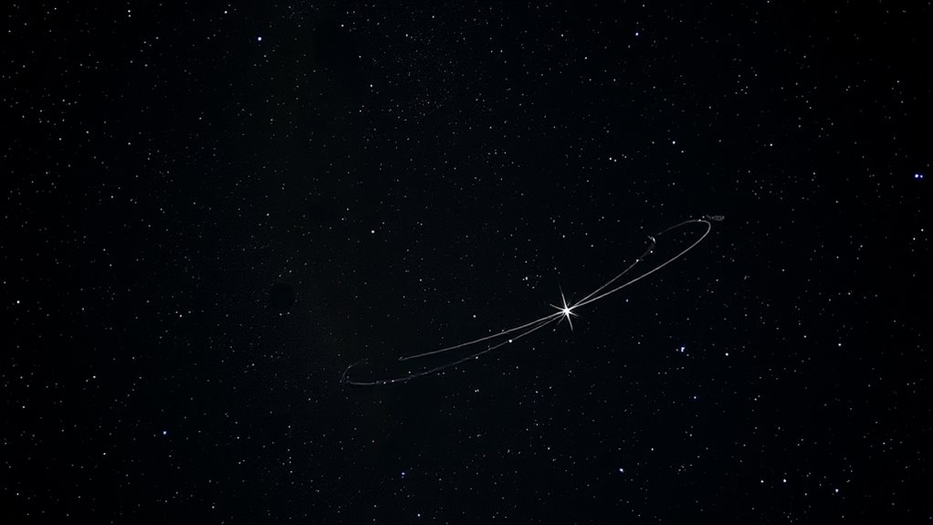
Yes, some stars and objects need special star adjustments and object specific corrections. Bright, nearby stars like Polaris or Betelgeuse often require precise adjustments because their positions can shift due to proper motion. Deep-sky objects such as galaxies or nebulae might also need specific corrections for accurate viewing. Always check updated catalogs and consider local observational conditions to guarantee your data is as precise as possible for these objects.
Conclusion
Mastering RA and Dec is like learning to navigate a starry map—you’ll avoid getting lost in the cosmos. By following proper conversion techniques, using reliable tools, and staying updated on celestial movements, you’ll keep your astronomical pursuits precise as a laser beam. Remember, each step you take is like turning a compass needle steadily toward clarity. Keep practicing, and soon you’ll confidently chart the heavens with the skill of a seasoned stargazer.